
Accurate drone volume measurement is crucial for many industries. Our services provide rapid and precise volumetric data. Utilize advanced drone technology for your projects. This ensures safety and efficiency on site


Drone Volumetric Measurements & Calculations offer unparalleled accuracy. A drone volumetric survey forms the core of this service. It employs advanced unmanned aerial vehicles (UAVs). We deliver precise data crucial for your project’s success. Effective stockpile volume drone assessment begins here, supporting industries like mining, construction, and agriculture with essential inventory management.
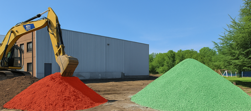
Drones capture numerous overlapping aerial images of material piles. Specialized software then processes these images. It generates a precise volume model of your site by comparing the stockpile’s shape to a reference surface.
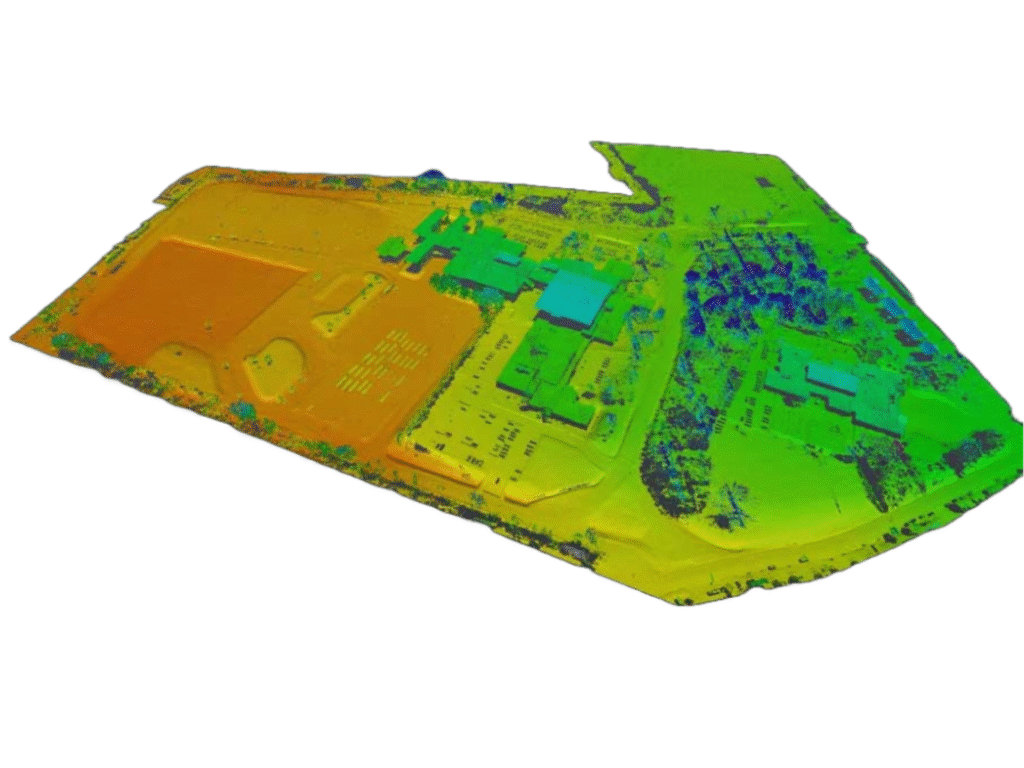
LiDAR is highly effective for complex terrains, particularly in dense vegetation area, LiDAR will be able to reaches ground. A drone LiDAR volume survey provides dense point clouds. This detail enables accurate drone cut-and-fill calculation and drone earthwork measurement for various projects.
We implement Ground Control Points (GCPs) for maximal precision. GCPs are clearly marked points with known coordinates. They ensure centimetre-level RTK accuracy in your drone site volume audit and mapping.
Gain rapid insights and optimize resources with our services. Our aerial volumetric analysis provides actionable data. Make informed decisions for mining, aggregates, and construction.
Drone surveys significantly reduce field time. Measure extensive areas and stockpiles quickly. This is much faster than traditional survey methods, making regular drone volume monitoring highly efficient.
Achieve centimetre-level accuracy with RTK/PPK technology. Our drone stockpile inventory services use precise GCPs. This minimizes errors in drone bulk material volume assessment.
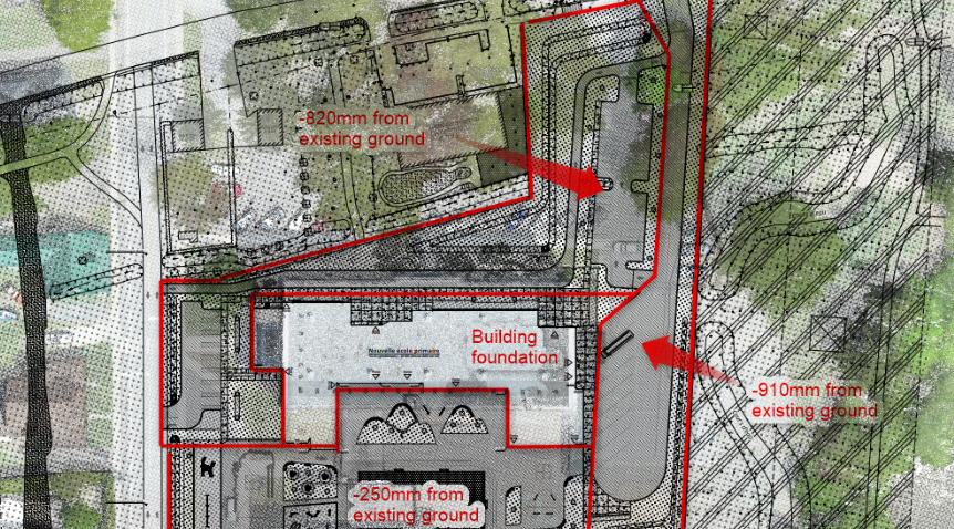
Receive detailed 3D volume models and comprehensive reports. This actionable data supports crucial decision-making. Use it for drone mass haul analysis and material management by comparing stockpile surveys to design files.
Keep your personnel safe by reducing on-site risks. Drones access hazardous or difficult-to-reach areas. This eliminates dangers associated with manual stockpile measurements.
Reduce overall project costs significantly. Faster surveys mean lower labour expenses and less equipment usage. Optimize resource allocation with precise drone aggregate pile mapping.
Track site progress and changes over time effectively. Compare current drone quarry volumetrics to previous surveys. Monitor your drone mine stockpile calculation and overall site development with precision mapping.

A drone volumetric survey uses UAVs to capture data. This data is then used to calculate volumes. It is commonly applied to stockpiles, earthworks, and mining operations.
It is very accurate. With RTK/PPK technology and precisely placed GCPs, we achieve centimetre-level precision. This ensures high-accuracy drone volumetrics for reliable inventory.
Many industries benefit from these advanced services. Key sectors include mining, construction, and agriculture. Quarries and aggregate suppliers also heavily rely on drone earthwork measurement.
Data acquisition using drones is rapid. Initial results and volume reports can often be processed within 24-48 hours. The exact time depends on the project’s scale and complexity.
We deliver comprehensive drone volume reporting. This includes detailed 3D models and precise point clouds. Data can be integrated with your existing GIS or BIM platforms.
Our drone volumetric measurement and calculation services provide the speed, accuracy, and safety your projects demand. Trust our expertise for your drone material inventory audit and drone volume reporting needs.
We use cookies to enhance your experience. Choose which cookies you allow: