
Topographic mapping is essential for understanding specific land characteristics. It provides precise elevation data critical for various projects. Accurate terrain information ensures informed decisions and successful outcomes.


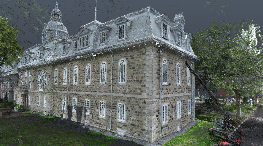
Topographic mapping involves the precise measurement and representation of land features. This service, a key part of professional land surveying, produces detailed maps. These maps illustrate natural and artificial elements, with elevation data being a primary output. It captures the complete site topography.
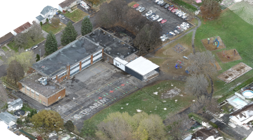
Surveyors employ advanced tools for comprehensive data capture. GPS surveying provides exact location points for features. Drone photogrammetry allows for rapid and efficient aerial data collection over large areas.
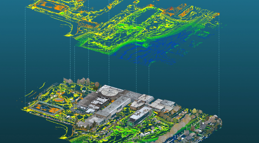
Specialized software processes the collected field measurements. This transformation creates a precise digital terrain model (DTM). Often, a 3D terrain model is also generated for enhanced visualization and analysis.
Final maps clearly detail the complete site topography. Clients receive vital geospatial data for diverse applications. This data seamlessly integrates with GIS mapping systems for further analysis.
Investing in topographic mapping offers significant project advantages. It is fundamental for an effective site planning survey. This data can identify potential flood zones or calculate slope percentages. Precise data helps avoid costly planning errors during development. A land surveyor illustrates terrain dimensions and integrates all elements like buildings, water streams, and contour lines. This is typically done at the start of a project, including measurements of roads, utilities, trees, and rivers.
We deliver exceptionally high-accuracy elevation data for your projects. This ensures reliable terrain elevation contours are present on all maps. Decisions based on our precise data are always sound and dependable.
Our surveys provide a comprehensive site grading analysis. We meticulously detail buildings, streams, utilities, and other crucial elements. This includes occupancy, layouts, and neighbouring structures for complete understanding.
We utilize advanced technologies such as LiDAR scanning for superior results. Remote sensing survey techniques further enhance our data collection capabilities. This ensures both efficient and highly accurate project outcomes.
We tailor map outputs to match your preferred formats and coordinate systems, ensuring seamless integration with your design, engineering, or GIS workflows.
Our high-resolution mapping includes detailed orthoimagery for exceptional clarity. All surveys use established survey control points, survey benchmarks, and precise ground control survey methods to ensure accuracy and consistency across every project.
We provide essential support for construction staking for new projects. An as-built survey verifies existing conditions against design plans. Our civil engineering survey data is indispensable for infrastructure projects.

Topographic maps are used extensively for project planning and design. They help engineers and architects understand the land’s specific characteristics. This includes detailed site planning survey work and infrastructure design.
Accuracy depends on the methods and equipment like GPS surveying. Modern techniques like LiDAR scanning offer very high precision. Our surveys are carried out with methods that align with recognized industry practices, and accuracy levels depend on the project requirements and technology used.
The duration varies with site size, complexity, and required detail. Small residential lots might take a day or two. Larger commercial or undeveloped tracts can take considerably longer.
Contour lines, key to contour mapping, connect points of equal elevation. They vividly illustrate the shape and steepness of the terrain. Closely spaced lines indicate steep slopes; wider spacing means flatter ground.
Many construction, development, and land management projects require one. It aids in design, earthwork calculations, and avoiding potential issues. Consulting us can clarify your specific project needs.
Contact us for expert topographic mapping services to ensure your project's success from the ground up.
We use cookies to enhance your experience. Choose which cookies you allow: