
Photogrammetry services transform physical spaces into precise digital assets. They enable the creation of detailed 3D point cloud models. This technology offers accurate data for informed decision-making across various projects.


Photogrammetry services provide advanced methods for capturing comprehensive site data. Drone photogrammetry is a leading technique in aerial mapping services. This process facilitates detailed 3D point cloud generation for diverse applications. Such geospatial data capture is fundamental for modern surveying and creating highly accurate models.
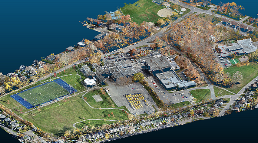
Our UAV mapping solutions ensure high-precision data acquisition. We deliver accurately georeferenced point clouds. This precision is vital for reliable photogrammetric surveying and creating detailed topographic point clouds.
Benefit from comprehensive orthoimagery production for clear visual context. We also generate crucial digital elevation models (DEMs). These outputs support thorough terrain modeling and enhance overall site understanding for your projects.

Our services support detailed construction progress mapping. We also specialize in heritage site digitization. These diverse applications showcase the versatility of modern reality capture services. We provide detailed as-built 3D documentation.
Replace guesswork with great work using our solutions. Access on-demand imagery and quantities from any device. Improve site safety and keep documentation current for efficient project management and informed decision-making.
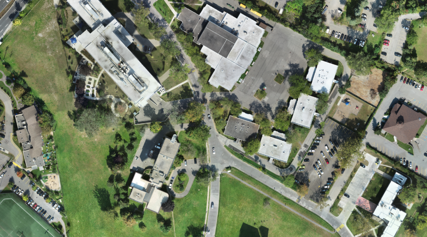
Receive seamless, high-resolution aerial images. These are georeferenced for direct use in GIS applications. They provide a clear visual overview for planning.
Get bare-earth DEMs for precise topographical analysis. DSMs include buildings and vegetation. Both aid in comprehensive terrain modeling.
We deliver dense 3D point clouds for detailed spatial analysis. These are foundational for cloud-to-mesh conversion. They enable further intricate modeling.
Obtain detailed measurements with our accurate volumetric analysis. Our reports support precise asset management. This helps you track stockpile volumes effectively.
Explore realistic and interactive 3D representations. These are perfect for presentations. They also integrate with VR/AR, including BIM-ready point clouds.
All deliverables come in formats compatible with your software. Use them with GIS (e.g., .shp) and CAD (e.g., .dxf) platforms. This ensures smooth workflow integration.

Photogrammetry services use photographs captured from various angles. These images create detailed 3D models or maps. Precision site mapping is a very common application of this technology.
3D point cloud generation involves processing many overlapping images. Software identifies common points between them. This process builds a dense cloud of 3D coordinates representing the subject accurately.
Drone photogrammetry offers rapid data acquisition for large areas. It significantly enhances safety by reducing fieldwork. It is also a cost-effective solution for many survey needs.
Yes, we deliver BIM-ready point clouds. These files integrate directly into Building Information Modeling software. This integration facilitates efficient design and construction workflows for your projects.
The accuracy of photogrammetric surveying depends on project specifications. It can achieve centimetre-level precision. This high accuracy requires proper ground control points and quality imaging techniques.
Enhance your projects with our expert photogrammetry services. Gain actionable insights from precise 3D point cloud models. Our team provides tailored solutions, from aerial mapping services to complex surface reconstruction, for your specific needs.
We use cookies to enhance your experience. Choose which cookies you allow: