
Unlock unparalleled insights for your projects. Our drone survey services provide accurate, timely data for superior tracking. We help construction and infrastructure sectors enhance efficiency and decision-making through advanced aerial intelligence.


Drone survey data for project tracking & monitoring offers a transformative approach to overseeing your site. This technology captures precise information quickly and efficiently. Effective drone project tracking provides real-time updates, significantly reducing manual labour. It also delivers enhanced accuracy compared to traditional methods. Furthermore, drone progress monitoring is essential for maintaining project timelines and budgets.
Drones dramatically speed up site surveying processes. This efficiency reduces labour costs significantly. Specialized software processes drone survey data swiftly, generating reports with quick turnaround. Managers receive real-time updates for prompt action.
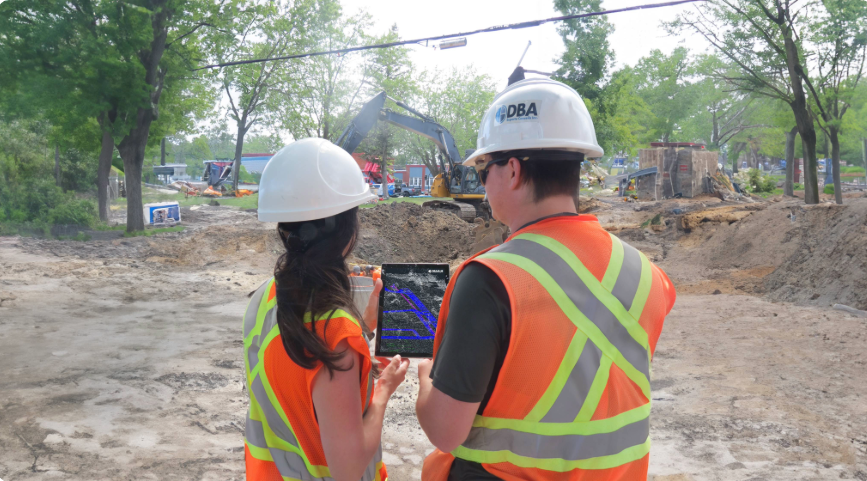
Drones access dangerous or hard-to-reach areas with ease. This capability enhances worker safety by eliminating direct risks. Critical assets and construction zones undergo thorough drone inspection tracking without human entry. Obtain vital drone site status updates safely.
Capture new drone imagery at flexible intervals, such as daily, weekly, or monthly. Drones ensure uniform perspectives, altitudes, and locations for each survey. This consistency in drone timeline documentation and drone progress orthomosaic creation simplifies progress comparison. It boosts productivity and helps cut project costs.
Our drone survey solutions integrate smoothly with your existing digital tools. Survey your site to create precise 3D models of current conditions. Cloud-based analytics allow easy calculation of your project’s full scope. Track progress against designs, getting an accurate snapshot of completed work and remaining tasks. Access detailed site maps and measurements from anywhere, on desktop or mobile, ensuring data is always on hand for approved stakeholders via secure, customizable user permissions. This supports efficient drone project dashboard integration and drone GIS project monitoring.
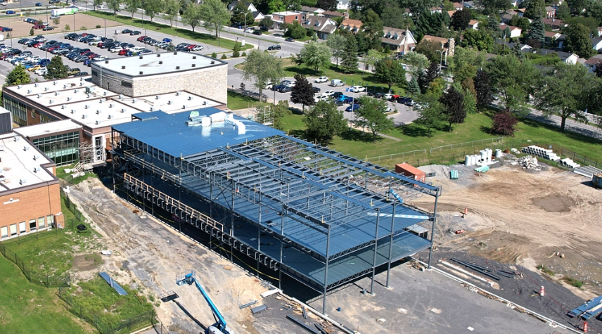
Obtain precise drone as-built survey data quickly. Compare actual site progress against initial design plans. This ensures all project specifications are met accurately and efficiently.
Utilize advanced drone change detection technology. Identify any modifications or deviations from plans promptly. This allows for effective monitoring of site evolution over the project lifecycle.
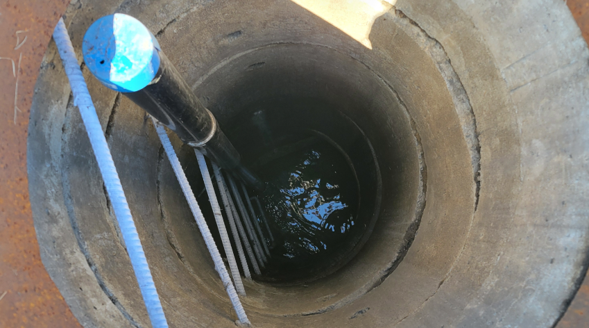
Perform precise drone volumetric change tracking for all earthworks. Monitor stockpiles and material movement with high accuracy. This optimises resource management and cost control for drone earthwork monitoring and drone stockpile tracking.
Leverage detailed drone site analytics for better-informed decisions. Gain crucial insights into your project's performance. Enhance overall drone construction analytics and management strategies.
Receive timely drone progress reporting with actionable insights. Keep all stakeholders informed with up-to-date visuals and data. This facilitates transparent communication and collaboration throughout the project using real-time drone survey data.
Benefit from regular UAV photogrammetry updates. We create detailed drone 3D progress models and orthomosaics. Visualize your project status with exceptional clarity and detail.

Construction, infrastructure, mining, and large-scale development projects benefit greatly. Drone data aids drone construction monitoring and tracks drone infrastructure progress effectively.
Frequency depends on project pace and specific needs. Options include drone weekly site survey, bi-weekly, or monthly updates. This ensures timely drone mapping updates for your team.
Yes, our data seamlessly integrates with common BIM and GIS platforms. We support drone project dashboard integration for streamlined workflows and easy data access. For more on data standards, see Natural Resources Canada guidelines.
Drone surveys provide highly accurate data, often achieving centimetre-level precision. This accuracy is vital for tasks like drone as-built survey creation and drone volumetric change tracking.
Absolutely. Drone remote monitoring capabilities allow stakeholders to view site progress from anywhere in the world. This enhances collaboration and speeds up decision-making processes.
Discover how drone survey data can transform your project tracking and monitoring. Improve efficiency and gain critical insights.
We use cookies to enhance your experience. Choose which cookies you allow: